A yellow weather warning has been issued for heavy showers and thunderstorms Wednesday and Thursday, including the potential for flooding and power cuts.
The Met Office predicts some areas could see as much as a month's rainfall in a few hours.
Large downpours are forecast tonight in the south of England - from Hampshire to Kent, with London and Essex also set to be hit.
Those places could experience up to 3cm (1in) of rain within an hour.
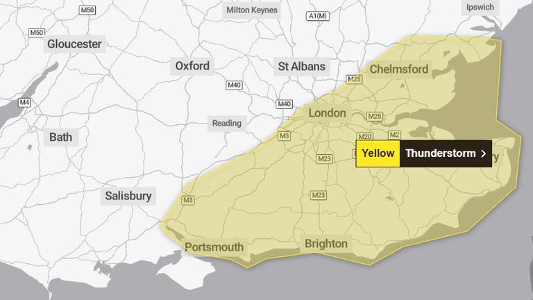
From early on Thursday morning, the warning area extends to cover most of England and Wales, as far north as Northumberland - up to 4cm (1.5in) could be expected in an hour.
There is also a small risk tomorrow of more than 6cm (2in) in two to three hours, along with frequent lightning at times, although that is more likely in southeast England and East Anglia.
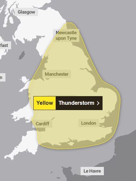
Scattered heavy showers and thunderstorms are expected to develop throughout Thursday afternoon and evening across parts of central, southern and eastern England, and potentially South Wales.
Forecasters say there is a risk of gusty winds, large hail, as well as flooding, which could lead to difficult driving conditions, road closures, and disruption to trains and buses.
They are warning homeowners and businesses that power cuts might also happen.
Check the weather where you are
This week, the UK Health Security Agency (UKHSA) issued yellow heat health warnings across England - except the northeast and northwest - until Friday.


Meanwhile, Tuesday is expected to be confirmed as the hottest day of the year so far, breaking this year's previous high of 31.9C.
Kew Gardens and Heathrow, both in west London, registered temperatures of 32C (89F).
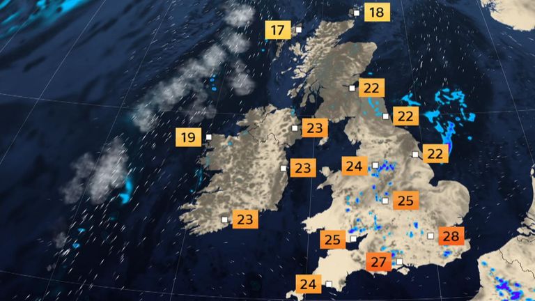
It is likely to feel sticky on Wednesday and Thursday - when it could remain as warm as 30C (86F) or above - before dropping off next week.
Read more:
Number of 'very hot' days has trebled
World breaks hottest day record
But for now, the Met Office says overnight temperatures are going to be very high.
The suggestion is to open windows at night, try to let some of the cooler air in, and keep curtains or blinds shut during the day.
Disclaimer: The copyright of this article belongs to the original author. Reposting this article is solely for the purpose of information dissemination and does not constitute any investment advice. If there is any infringement, please contact us immediately. We will make corrections or deletions as necessary. Thank you.