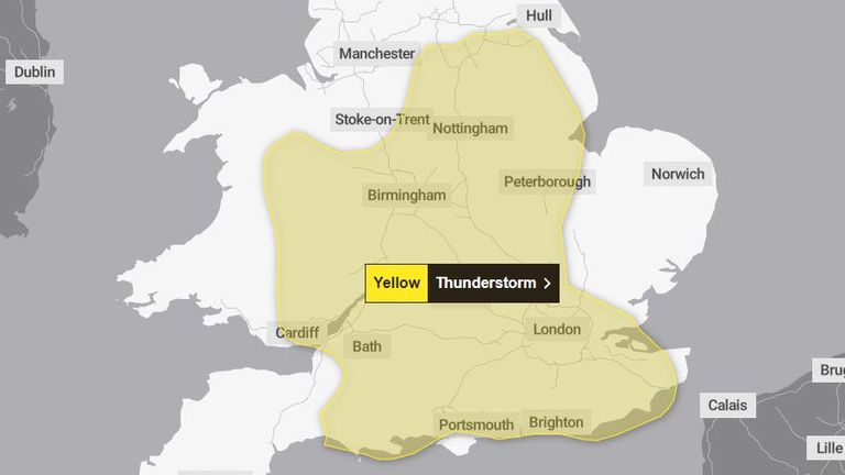
The Met Office has updated its yellow weather warning for slow-moving heavy showers and thunderstorms in parts of England and Wales.
Forecasters now predict central and southern England, and east and southeast Wales, are most likely to be affected Thursday afternoon and evening.
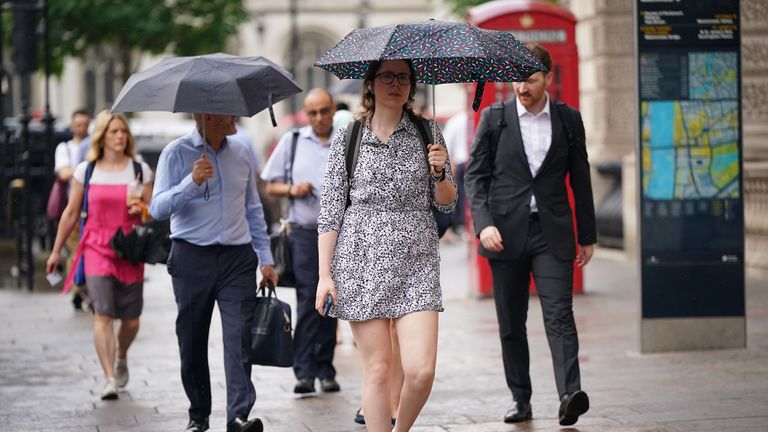
Torrential downpours could produce 5cm (2in), or more, in one or two hours although there is a "small chance" of 10cm (4in) over the course of a few hours.
There is also a warning about gusty winds, lightning, large hail, and also flooding.
The area covered by the yellow warning has been revised - shrinking slightly since the initial predictions on Wednesday - but remaining in force until 11.59pm.
Although the forecast does say showers and thunderstorms could re-develop overnight in parts of eastern England.
In Birmingham, flood alerts have been issued on parts of the Upper Tame, along with the River Stour, Rea and Cole - as well as the River Blythe in Warwickshire.
Meanwhile, around Nottinghamshire the River Maun, Trent and Leen are also on alert, as are several small brooks and tributaries around London.
Check the weather where you are
England's flood warning service has issued a series of pre-emptive advisories, because of the forecast for heavy rainfall, but adding there is low confidence over exact timing and locations.
This week, the UK Health Security Agency (UKHSA) issued yellow heat health warnings across England - except the northeast and northwest - until Friday.
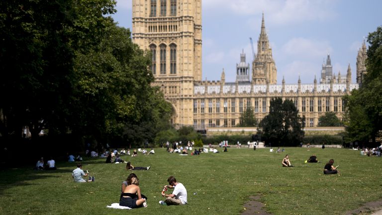
Meanwhile, Tuesday recorded the hottest day of the year so far, breaking this year's previous high of 31.9C.
Kew Gardens and Heathrow, both in west London, registered temperatures of 32C (89F).
Keep up with all the latest news from the UK and around the world by following Sky News
It is likely to feel sticky on Thursday - temperatures typically expected to remain as warm as 28C (82F) or above - before dropping off slightly on Friday but remaining humid.
Read more:
Number of 'very hot' days has trebled
World breaks hottest day record
The Met Office says overnight temperatures could be high for some - but there is advice to help people get some sleep.
The suggestion is to open windows at night, try to let some of the cooler air in, and keep curtains or blinds shut during the day.
Disclaimer: The copyright of this article belongs to the original author. Reposting this article is solely for the purpose of information dissemination and does not constitute any investment advice. If there is any infringement, please contact us immediately. We will make corrections or deletions as necessary. Thank you.