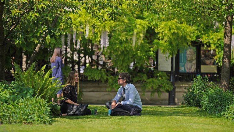
The UK is set to bask in the hottest temperatures of the year so far on Saturday, as parts of the country see highs of 26C (79F) and the summery feel is set to continue on Sunday until thunderstorms roll in.
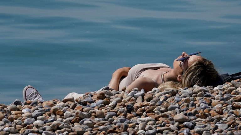
The highest temperatures are expected in the South East on Saturday and there's even a chance of 28C (82F) on Sunday.
If forecasts for either day are reached, then it will mark the highest temperature of the year so far. The 24.6C (77F), seen in London on Thursday (the current hottest day of the year so far) was well above the Met Office's monthly average of 15C (59F).
See the latest weather forecast where you are
But the picture is expected to dramatically change on Sunday afternoon, when yellow warnings have been issued for thunderstorms for large of parts of the UK as forecasters warn of "thundery breakdowns" with the potential for intense rainfall.
The warning is in place from noon to 10pm on Sunday and covers northwest England, most of Wales, much of central England and the South West.
Sky News's weather presenter Kirsty McCabe said: "The weekend starts off warm and sunny but is set to end with a bang as thundery downpours move in from the West.
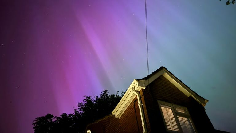
"Friday night was very mild with clear skies for many - great conditions for those who were watching the Northern Lights. And you might get lucky again tonight [Saturday]!"
She said Saturday will be "another warm and sunny day with temperatures widely into the low to mid-20s".
"We could get highs of 26C, mostly likely across parts of the Midlands and southeast England, but there's the chance of showers in some parts," she said.
"Sunday will be hotter and more humid, up to 27C or even 28C (82F) in the South East.
"However, thunderstorms will move in from the West and could bring 30 to 50mm (1.2-2 inches) of rain in just a few hours, along with hail, lightning and gusty winds.
"That signals a change to cooler and more unsettled weather next week."
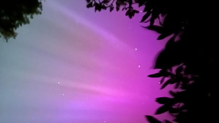
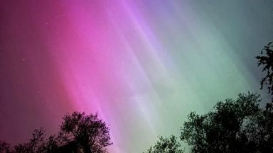
Parts of the country were treated to a stunning light display by the Northern Lights on Friday night.
Northern Lights - see all the best pictures overnight here
A severe solar storm meant the Aurora Borealis, usually only visible from northern parts of the British Isles, was enjoyed by people across large parts of the UK, including Scotland, Wales, Northern Ireland and, unusually, southern England.
Read more from Sky News:
Bambie Thug calls for Eurovision 'humanity'
Police officer shot with crossbow
Djokovic hit in head by water bottle
The huge solar storm was created by successive coronal mass ejections (CMEs) that have left space a "mess", one space physicist told Sky News.
CMEs are when a large cloud of high energy plasma erupts from the Sun, into space, and currently there is a sunspot spitting a number out - aimed right at Earth.
Disclaimer: The copyright of this article belongs to the original author. Reposting this article is solely for the purpose of information dissemination and does not constitute any investment advice. If there is any infringement, please contact us immediately. We will make corrections or deletions as necessary. Thank you.